Did You Know?
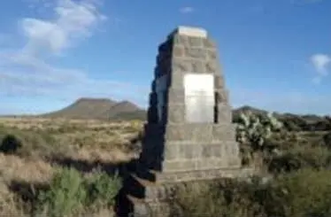
The Battle of Boomplaats, fought on 29 August 1848, was the first major military engagement between British colonial forces and Boer Voortrekkers. It took place near the small town of Jagersfontein in the present-day Free State province, though the battlefield itself lies about 20 kilometres south of Jagersfontein, along the R704 road. The battle was the culmination of British efforts to assert control over the territory between the Orange and Vaal rivers, which had been settled by Voortrekkers who had left the Cape Colony in the 1830s. British Governor Sir Harry Smith proclaimed British sovereignty over the region in February 1848, leading to resistance from the Boer leader Andries Pretorius, who had previously defeated the British at the Battle of Congella in 1842 and had been a key figure in the Natal settlement before its annexation. Pretorius gathered a force of about 400 to 500 Boers and confronted a British column of roughly 800 soldiers, including infantry, cavalry, and artillery, commanded by Sir Harry Smith himself. The Boers took up a defensive position on a low ridge near the Boomplaats farm, but the British used their superior artillery and disciplined infantry tactics to dislodge them. The battle lasted several hours, with the Boers eventually retreating after suffering around 50 casualties, including killed and wounded. British losses were lighter, with about 15 killed and 40 wounded. The Boer defeat effectively ended organised resistance to British rule in the area, and the territory was formally annexed as the Orange River Sovereignty, which lasted until 1854 when it was abandoned and became the independent Orange Free State. The site is historically significant as a symbol of the broader Voortrekker struggle against British imperial expansion, and it is sometimes referred to as the first battle of the Anglo-Boer conflicts, predating the more famous wars of 1880-1881 and 1899-1902. Today, the battlefield is marked by a small monument and a cemetery containing the graves of some of the fallen Boers. The exact location of the battle is on private farmland, and while it is not a formally developed heritage site with visitor facilities, it remains a place of interest for historians and those tracing the early history of Afrikaner nationalism and British colonialism in southern Africa.
AI-assisted · may contain inaccuracies
Activations (0)
No activations recorded for this site yet.